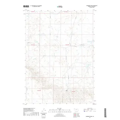
2017 Map of Warbonnet Ranch
USGS Topo · Published 2017About this map
Monroe Canyon defines the southern reach of this Sioux County landscape, where the high plains of northwest Nebraska transition into complex drainages. The area is characterized by a sophisticated network of water management features, including Shepherd Reservoir, Caladonia Reservoir, and Snyder Reservoir. These catchments, along with named tanks like Wasserburger Reservoir Number 1 and Little Red Reservoir, suggest a ranching economy reliant on capturing seasonal runoff from intermittent streams such as Warbonnet Cr and Prairie Dog Cr.
Find a feature on this map
28 named features on this map. Tap any name to fly to it.
Don’t see what you’re looking for? This feature index may not catch every label — zoom into the map to look around manually.
Map Details
Editions of this 2017 Warbonnet Ranch Map
This is the sole edition of this map. No revisions or reprints were ever made.
Other maps of this area

1954 · Torrington
USGS Topo · 1:250,000

1955 · Alliance
USGS Topo · 1:250,000

1957 · Alliance
USGS Topo · 1:250,000

1958 · Torrington
USGS Topo · 1:250,000

1958 · Alliance
USGS Topo · 1:250,000

1977 · Van Tassell
USGS Topo · 1:24,000

1978 · Harrison West
USGS Topo · 1:24,000
1978 · Sherrill Hills
USGS Topo · 1:24,000

1978 · Kirtley
USGS Topo · 1:24,000

1979 · Harrison East
USGS Topo · 1:24,000