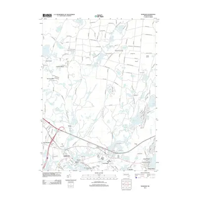
2012 Map of Wareham
USGS Topo · Published 2012About this map
Wareham and the surrounding coastal lowlands are defined by an intricate network of waterways and cranberry bogs, including Smalley Bogs and the Wankinco River Reservoir. The settlement pattern reflects the area's diverse uses, from the residential clusters at Pine Tree Village and Cranberry Village to the institutional footprint of the Massachusetts Correctional Institution Forestry Camp. Along the southern shoreline, communities like Indian Mound Beach and Jefferson Shores line the Buzzards Bay inlets, while the inland economy is marked by reservoirs like Frogfoot Reservoir and Harlow Brook Reservoir. Genealogists will find interest in several historic burial grounds, including Central Cem and Saint Patricks Cem. This coastal landscape also preserves significant recreational and conservation spaces, notably the Cachalot Scout Reservation and Camp Squanto.
Find a feature on this map
218 named features on this map. Tap any name to fly to it.
Don’t see what you’re looking for? This feature index may not catch every label — zoom into the map to look around manually.
Map Details
Editions of this 2012 Wareham Map
This is the sole edition of this map. No revisions or reprints were ever made.
Other maps of this area

1885 · New Bedford
USGS Topo · 1:62,500

1885 · Middleboro
USGS Topo · 1:62,500

1886 · Falmouth
USGS Topo · 1:62,500

1886 · Plymouth
USGS Topo · 1:62,500

1888 · New Bedford
USGS Topo · 1:62,500

1888 · Falmouth
USGS Topo · 1:62,500

1888 · Middleboro
USGS Topo · 1:62,500

1889 · Plymouth
USGS Topo · 1:62,500

1893 · Middleboro
USGS Topo · 1:62,500

1893 · Falmouth
USGS Topo · 1:62,500