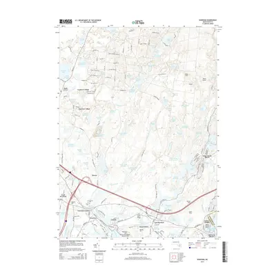
2015 Map of Wareham
USGS Topo · Published 2015About this map
Cranberry Village and Pine Tree Village sit within a landscape defined by extensive water management systems, including the Crane Brook Bog Reservoir and E-Head Bog Reservoir. The map illustrates the transition from the wooded interiors near South Carver to the coastal development of Wareham Center and East Wareham. The region's hydraulic history is evident in the density of named ponds and reservoirs, such as Federal Pond and the Wankinco River Reservoir, which support the local agriculture and industry.
Find a feature on this map
192 named features on this map. Tap any name to fly to it.
Don’t see what you’re looking for? This feature index may not catch every label — zoom into the map to look around manually.
Map Details
Editions of this 2015 Wareham Map
This is the sole edition of this map. No revisions or reprints were ever made.
Other maps of this area

1885 · New Bedford
USGS Topo · 1:62,500

1885 · Middleboro
USGS Topo · 1:62,500

1886 · Falmouth
USGS Topo · 1:62,500

1886 · Plymouth
USGS Topo · 1:62,500

1888 · New Bedford
USGS Topo · 1:62,500

1888 · Falmouth
USGS Topo · 1:62,500

1888 · Middleboro
USGS Topo · 1:62,500

1889 · Plymouth
USGS Topo · 1:62,500

1893 · Middleboro
USGS Topo · 1:62,500

1893 · Falmouth
USGS Topo · 1:62,500