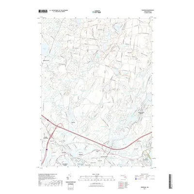
2021 Map of Wareham
USGS Topo · Published 2021About this map
Cranberry cultivation defines the landscape of this coastal Massachusetts quadrangle, where a complex network of managed wetlands like the Wankinco Cranberry Bog and Tihonet Cranberry Bogs weave between glacial ponds. The region is anchored by the settlement of Wareham, with several distinct residential pockets such as Oakdale, East Wareham, and the waterfront community of Indian Mound Beach. The Wankinco River and Agawam River converge near the town center, flowing toward the Broad Marsh River and the head of Buzzards Bay. This late-stage survey details the transition from traditional industry to modern residential development, including the Minot Forest parkland and established burial grounds like Saint Patricks Cem and Centre Cem. The extensive labeling of specific agricultural features like Parker Mills Bogs and Rogers Bogs provides an intricate look at the land use patterns that have shaped Plymouth County’s heritage.
Find a feature on this map
225 named features on this map. Tap any name to fly to it.
Don’t see what you’re looking for? This feature index may not catch every label — zoom into the map to look around manually.
Map Details
Editions of this 2021 Wareham Map
This is the sole edition of this map. No revisions or reprints were ever made.
Other maps of this area

1885 · New Bedford
USGS Topo · 1:62,500

1885 · Middleboro
USGS Topo · 1:62,500

1886 · Falmouth
USGS Topo · 1:62,500

1886 · Plymouth
USGS Topo · 1:62,500

1888 · New Bedford
USGS Topo · 1:62,500

1888 · Falmouth
USGS Topo · 1:62,500

1888 · Middleboro
USGS Topo · 1:62,500

1889 · Plymouth
USGS Topo · 1:62,500

1893 · Middleboro
USGS Topo · 1:62,500

1893 · Falmouth
USGS Topo · 1:62,500