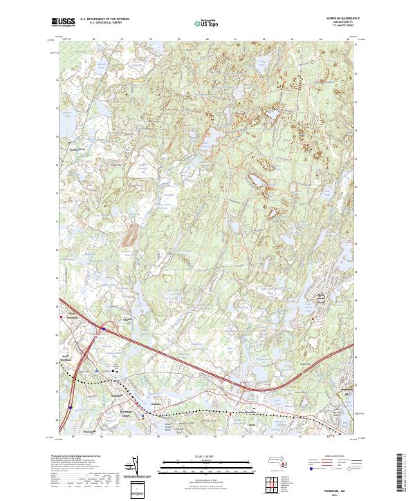
2024 Map of Wareham
USGS Topo · Published 2024About this map
Wankinco Cranberry Bog and several other extensive agricultural wetlands such as Old Orchard Bogs define the unique industrial-natural landscape of this Plymouth County region. The map illustrates a complex water management system where reservoirs like Harwich Reservoir and Frogfoot Brook Reservoir support the region's historic cranberry production. Settlement patterns are concentrated along the Agawam River and the coast, where neighborhoods like Wareham Center, Onset, and Weweantic sit adjacent to the salt marshes of Muddy Cove. Modern infrastructure, including the CSX rail line and major highways, bisects established residential areas and local landmarks such as Centre Cem. Further north, the dense canopy of Myles Standish State Forest provides a stark contrast to the developed shoreline and the sandy reaches of Indian Mound Beach on Buzzards Bay.
Find a feature on this map
241 named features on this map. Tap any name to fly to it.
Don’t see what you’re looking for? This feature index may not catch every label — zoom into the map to look around manually.
Map Details
Editions of this 2024 Wareham Map
This is the sole edition of this map. No revisions or reprints were ever made.
Other maps of this area

1885 · New Bedford
USGS Topo · 1:62,500

1885 · Middleboro
USGS Topo · 1:62,500

1886 · Falmouth
USGS Topo · 1:62,500

1886 · Plymouth
USGS Topo · 1:62,500

1888 · New Bedford
USGS Topo · 1:62,500

1888 · Falmouth
USGS Topo · 1:62,500

1888 · Middleboro
USGS Topo · 1:62,500

1889 · Plymouth
USGS Topo · 1:62,500

1893 · Middleboro
USGS Topo · 1:62,500

1893 · Falmouth
USGS Topo · 1:62,500