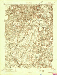
1935 Map of Wareham
USGS Topo · Published 1935About this map
The cranberry-growing industry and complex hydraulic systems of southeastern Massachusetts dominate this mid-1930s landscape. Extensive agricultural networks like Wankinco Bog, Federal Bogs, and Great Bogs illustrate the intensive land use required for local cultivation. These managed wetlands are interspersed among a dense cluster of kettle ponds and reservoirs, including the East Head Reservoir and Fearing Pond, which lie within the northern expanse of Myles Standish State Forest.
Find a feature on this map
97 named features on this map. Tap any name to fly to it.
Don’t see what you’re looking for? This feature index may not catch every label — zoom into the map to look around manually.
Map Details
Editions of this 1935 Wareham Map
This is the sole edition of this map. No revisions or reprints were ever made.
Other maps of this area

1885 · New Bedford
USGS Topo · 1:62,500

1885 · Middleboro
USGS Topo · 1:62,500

1886 · Falmouth
USGS Topo · 1:62,500

1886 · Plymouth
USGS Topo · 1:62,500

1888 · New Bedford
USGS Topo · 1:62,500

1888 · Falmouth
USGS Topo · 1:62,500

1888 · Middleboro
USGS Topo · 1:62,500

1889 · Plymouth
USGS Topo · 1:62,500

1893 · Middleboro
USGS Topo · 1:62,500

1893 · Falmouth
USGS Topo · 1:62,500