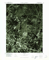
1977 Map of Wareham
USGS Topo · Published 1981About this map
Agricultural and residential patterns emerge with striking clarity across this 1977 orthophotoquad, which captures the coastal landscapes of Plymouth County during a period of significant regional transition. The industrial and transit hubs of Wareham and East Wareham anchor the southern portion of the sheet, where the Weweantic River and Agawam River meet the coastal inlets. To the north, the geometric shapes of cranberry bogs and rural homesteads define South Carver, illustrating the area's deep-rooted cranberry industry.
Find a feature on this map
7 named features on this map. Tap any name to fly to it.
Don’t see what you’re looking for? This feature index may not catch every label — zoom into the map to look around manually.
Map Details
Editions of this 1977 Wareham Map
This is the sole edition of this map. No revisions or reprints were ever made.
Other maps of this area

1885 · New Bedford
USGS Topo · 1:62,500

1885 · Middleboro
USGS Topo · 1:62,500

1886 · Falmouth
USGS Topo · 1:62,500

1886 · Plymouth
USGS Topo · 1:62,500

1888 · New Bedford
USGS Topo · 1:62,500

1888 · Falmouth
USGS Topo · 1:62,500

1888 · Middleboro
USGS Topo · 1:62,500

1889 · Plymouth
USGS Topo · 1:62,500

1893 · Middleboro
USGS Topo · 1:62,500

1893 · Falmouth
USGS Topo · 1:62,500