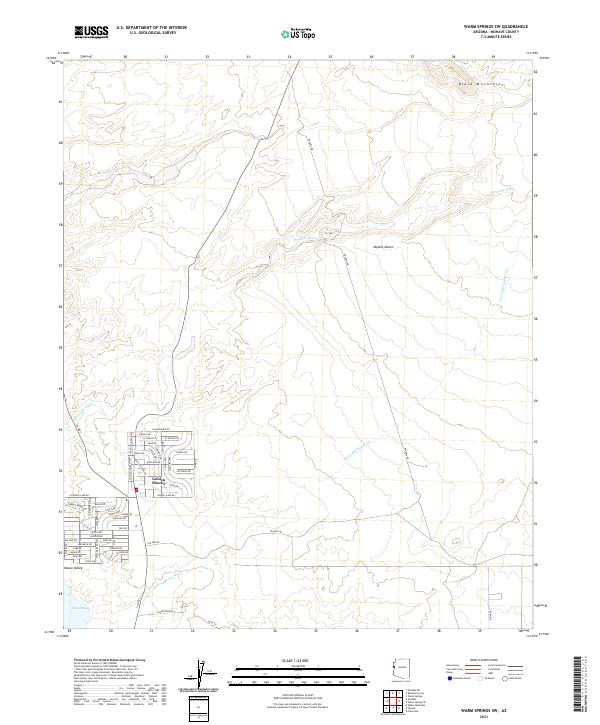
2021 Map of Warm Springs SW
USGS Topo · Published 2021About this map
Golden Shores serves as the primary residential hub on this arid landscape, situated just east of the expansive Topock Marsh. The street grid here, characterized by family and regional names like Apache Pkwy and Cibola Dr, reflects a modern settlement pattern within the broader Mohave Valley. The terrain is defined by the stark contrast between the flat alluvial plains and the rising peaks of the Black Mountains to the northeast.
Find a feature on this map
64 named features on this map. Tap any name to fly to it.
Don’t see what you’re looking for? This feature index may not catch every label — zoom into the map to look around manually.
Map Details
Editions of this 2021 Warm Springs SW Map
This is the sole edition of this map. No revisions or reprints were ever made.
Other maps of this area

1903 · Needles
USGS Topo · 1:125,000

1904 · Needles Special
USGS Topo · 1:125,000

1943 · Topock
USGS Topo · 1:62,500

1950 · Topock
USGS Topo · 1:62,500

1950 · Sawtooth Range
USGS Topo · 1:62,500

1950 · Needles
USGS Topo · 1:62,500

1951 · Topock
USGS Topo · 1:62,500

1951 · Sawtooth Range
USGS Topo · 1:62,500

1952 · Needles
USGS Topo · 1:62,500

1954 · Needles
USGS Topo · 1:250,000