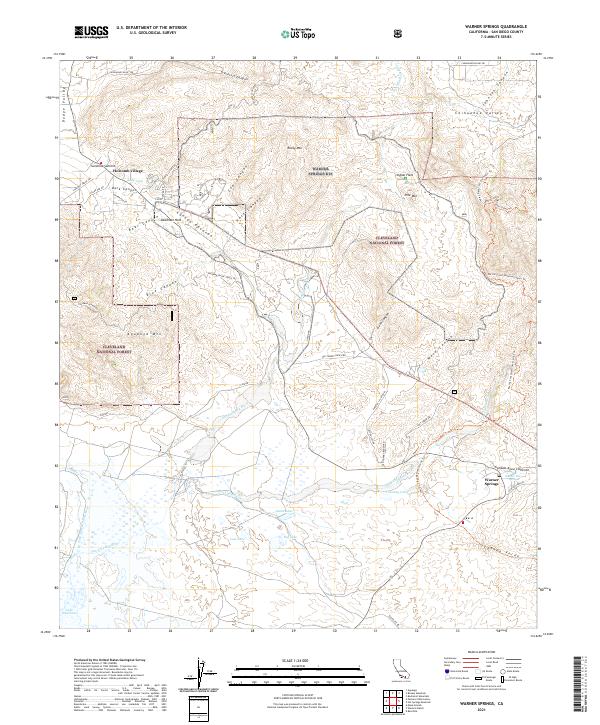
2021 Map of Warner Springs
USGS Topo · Published 2021About this map
Warner Springs and the nearby Warner Hot Spring anchor this high-elevation landscape in the northeastern corner of San Diego County. The area is defined by a series of high valleys, including Dodge Valley and the Chihuahua Valley, which sit amidst the rolling highlands of the Cleveland National Forest. This modern record traces the Pacific Crest National Scenic Trl as it winds through rugged landmarks like Deadman Hole and across Indian Flats, reflecting the region's enduring character as a destination for back-country recreation and transit. Seasonal water patterns are evident in the cluster of wetlands south of the San Luis Rey River, including Swan Lake, Big Lake, and Lost Lake, leading toward the northern edge of Lake Henshaw. Smaller settlements like Sunshine Summit and Holcomb Village mark the highway intersections that have long connected these mountain communities.
Find a feature on this map
57 named features on this map. Tap any name to fly to it.
Don’t see what you’re looking for? This feature index may not catch every label — zoom into the map to look around manually.
Map Details
Editions of this 2021 Warner Springs Map
This is the sole edition of this map. No revisions or reprints were ever made.
Other maps of this area

1903 · Ramona
USGS Topo · 1:125,000

1904 · Southern California Sheet No. 2
USGS Topo · 1:250,000

1939 · Warner Springs
USGS Topo · 1:62,500

1939 · Santa Ysabel
USGS Topo · 1:62,500

1939 · Palomar Mountain
USGS Topo · 1:62,500

1942 · Ramona
USGS Topo · 1:62,500

1943 · Santa Ysabel
USGS Topo · 1:62,500

1943 · Warner Springs
USGS Topo · 1:62,500

1947 · Ramona
USGS Topo · 1:62,500

1947 · Santa Ana
USGS Topo · 1:250,000