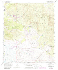
1958 Map of Warner Springs
USGS Topo · Published 1988About this map
The Valle de San Jose serves as the focal point for this high-desert landscape, where the waters of Agua Caliente Creek and the San Luis Rey River once fed a series of ephemeral basins including Swan Lake, Big Lake, and Lost Lake. The 1988 revisions, shown in purple, illustrate the modernization of the backcountry, including the expansion of the Puerta La Cruz Conservation Camp and the inclusion of the Pacific Crest Scenic Trail winding through the eastern foothills. Near the historic settlement of Warner Springs, cultural landmarks such as the Cem and Warner Union School appear alongside the well-known resort area. The terrain transitions from the elevations of Pine Mountain and Rocky Mountain down through several deep canyons like Rock Cow Canyon and Bear Canyon. Notable infrastructure including a Landing Strip, a Heliport, and the Fire Control Station reflects the area's role in regional forest management and aviation.
Find a feature on this map
41 named features on this map. Tap any name to fly to it.
Don’t see what you’re looking for? This feature index may not catch every label — zoom into the map to look around manually.
Map Details
Editions of this 1958 Warner Springs Map
This is the sole edition of this map. No revisions or reprints were ever made.
Other maps of this area

1903 · Ramona
USGS Topo · 1:125,000

1904 · Southern California Sheet No. 2
USGS Topo · 1:250,000

1939 · Warner Springs
USGS Topo · 1:62,500

1939 · Santa Ysabel
USGS Topo · 1:62,500

1939 · Palomar Mountain
USGS Topo · 1:62,500

1942 · Ramona
USGS Topo · 1:62,500

1943 · Santa Ysabel
USGS Topo · 1:62,500

1943 · Warner Springs
USGS Topo · 1:62,500

1947 · Ramona
USGS Topo · 1:62,500

1947 · Santa Ana
USGS Topo · 1:250,000