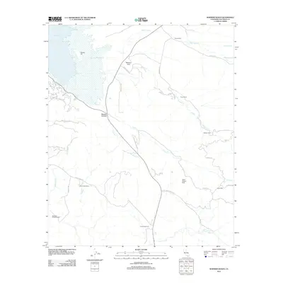
2012 Map of Warners Ranch
USGS Topo · Published 2012About this map
Warners Ranch and the surrounding high-altitude valleys of San Diego County are defined by a network of historic land holdings and ranching heritage. This 2012 survey captures a landscape where water is the primary architect of settlement, with the eastern shore of Lake Henshaw giving way to the seasonally dry courses of Matagual Cr and Carrizo Cr. The topography is anchored by Santa Ysabel Peak and Monkey Hill, which overlook a series of family-named ranches including Mesa Chiquita Ranch and Treanor Ranch.
Find a feature on this map
38 named features on this map. Tap any name to fly to it.
Don’t see what you’re looking for? This feature index may not catch every label — zoom into the map to look around manually.
Map Details
Editions of this 2012 Warners Ranch Map
This is the sole edition of this map. No revisions or reprints were ever made.
Other maps of this area

1903 · Ramona
USGS Topo · 1:125,000

1904 · Southern California Sheet No. 2
USGS Topo · 1:250,000

1939 · Warner Springs
USGS Topo · 1:62,500

1939 · Santa Ysabel
USGS Topo · 1:62,500

1939 · Palomar Mountain
USGS Topo · 1:62,500

1942 · Ramona
USGS Topo · 1:62,500

1943 · Santa Ysabel
USGS Topo · 1:62,500

1943 · Warner Springs
USGS Topo · 1:62,500

1947 · Ramona
USGS Topo · 1:62,500

1947 · Santa Ana
USGS Topo · 1:250,000