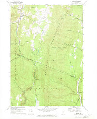
1970 Map of Warren
USGS Topo · Published 1972About this map
The Mad River valley serves as the primary corridor for settlement in this part of Washington County, where the village of Warren and its nearby Covered Bridge sit surrounded by the high peaks of the Northfield Mountains. By the early 1970s, the landscape reflected a mix of traditional agriculture and burgeoning recreation, evidenced by the presence of Alpine Village and the Warren Airport north of the main town. To the east, East Warren remains a high-plateau settlement near Warren Pinnacle, while the rugged eastern slopes are dominated by the Roxbury State Forest.
Find a feature on this map
50 named features on this map. Tap any name to fly to it.
Don’t see what you’re looking for? This feature index may not catch every label — zoom into the map to look around manually.
Map Details
Editions of this 1970 Warren Map
3 editions found
Other maps of this area

1915 · Rochester
USGS Topo · 1:62,500

1917 · Rochester
USGS Topo · 1:62,500

1919 · Royalton
USGS Topo · 1:62,500

1919 · Lincoln Mountain
USGS Topo · 1:62,500

1920 · Lincoln Mountain
USGS Topo · 1:48,000

1921 · Lincoln Mountain
USGS Topo · 1:62,500

1922 · Barre
USGS Topo · 1:48,000

1924 · Barre
USGS Topo · 1:62,500

1924 · Randolph
USGS Topo · 1:48,000

1926 · Randolph
USGS Topo · 1:62,500