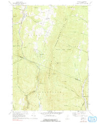
1970 Map of Warren
USGS Topo · Published 1991About this map
The Mad River valley serves as the primary corridor for settlement in this part of Washington County, where the village of Warren and its nearby Covered Bridge anchor the local geography. The landscape is defined by the steep elevation changes between the river basin and the surrounding Northfield Mountains. To the east, East Warren sits on higher ground near a Cem, while development at Alpine Village and the Warren Sugarbush Airport reflects the mid-century evolution of this mountain terrain into a recreational hub.
Find a feature on this map
51 named features on this map. Tap any name to fly to it.
Don’t see what you’re looking for? This feature index may not catch every label — zoom into the map to look around manually.
Map Details
Editions of this 1970 Warren Map
3 editions found
Other maps of this area

1915 · Rochester
USGS Topo · 1:62,500

1917 · Rochester
USGS Topo · 1:62,500

1919 · Royalton
USGS Topo · 1:62,500

1919 · Lincoln Mountain
USGS Topo · 1:62,500

1920 · Lincoln Mountain
USGS Topo · 1:48,000

1921 · Lincoln Mountain
USGS Topo · 1:62,500

1922 · Barre
USGS Topo · 1:48,000

1924 · Barre
USGS Topo · 1:62,500

1924 · Randolph
USGS Topo · 1:48,000

1926 · Randolph
USGS Topo · 1:62,500