
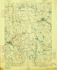
1887 Map of Warwick
USGS Topo · Published 1887About this map
The Connecticut River and Millers River serve as the primary corridors for transportation and settlement in this late 19th-century survey. Rail networks are well-established, with the Central Vermont R.R. New London Div. tracing the Connecticut and the Fitchburg R.R. following the winding path of the Millers River through Erving, Wendell Depot, and Orange. This industrial alignment is contrasted by the upland village of Warwick and the agricultural expanses of Beers Plain and Pine Meadow.
Find a feature on this map
131 named features on this map. Tap any name to fly to it.
Don’t see what you’re looking for? This feature index may not catch every label — zoom into the map to look around manually.
Map Details
Editions of this 1887 Warwick Map
This is the sole edition of this map. No revisions or reprints were ever made.
Other maps of this area

1885 · Northampton
USGS Topo · 1:62,500

1886 · Northampton
USGS Topo · 1:62,500

1887 · Belchertown
USGS Topo · 1:62,500

1887 · Winchendon
USGS Topo · 1:62,500

1887 · Barre
USGS Topo · 1:62,500

1889 · Barre
USGS Topo · 1:62,500

1889 · Warwick
USGS Topo · 1:62,500

1890 · Belchertown
USGS Topo · 1:62,500

1890 · Greenfield
USGS Topo · 1:62,500
1890 · Winchendon
USGS Topo · 1:62,500