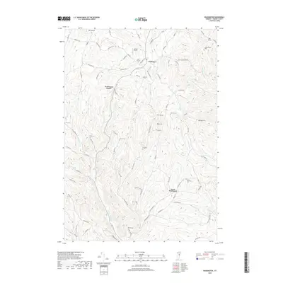
2018 Map of Washington
USGS Topo · Published 2018About this map
Washington serves as the central hub for this Orange County landscape, where the town’s namesake heights and the rural settlement of South Washington are connected by a network of hollows and family-named roads. The topography is defined by significant ridges like Mt Pleasant and Michigan Hill, carved by watercourses such as the First Br White River and Cookville Brook. For local historians and genealogists, the map is particularly rich in family burial sites, documenting names like Cheney Cem, Caswell Cem, and Bohonon Cem across the high country. The modern infrastructure of Carriers Skypark and Firehouse Ln contrasts with older landmarks like the Devils Den and Hart Hollow, illustrating a landscape that maintains its rural agricultural character while adapting to contemporary needs. Roads like Poor Farm Rd hint at the historical civic functions that once structured this Vermont community.
Find a feature on this map
86 named features on this map. Tap any name to fly to it.
Don’t see what you’re looking for? This feature index may not catch every label — zoom into the map to look around manually.
Map Details
Editions of this 2018 Washington Map
This is the sole edition of this map. No revisions or reprints were ever made.
Other maps of this area

1896 · Strafford
USGS Topo · 1:62,500

1919 · Royalton
USGS Topo · 1:62,500

1922 · Barre
USGS Topo · 1:48,000

1924 · Barre
USGS Topo · 1:62,500

1924 · Randolph
USGS Topo · 1:48,000

1926 · Randolph
USGS Topo · 1:62,500

1944 · Strafford
USGS Topo · 1:62,500

1947 · Corinth
USGS Topo · 1:62,500

1948 · East Barre
USGS Topo · 1:62,500

1950 · Glens Falls
USGS Topo · 1:250,000