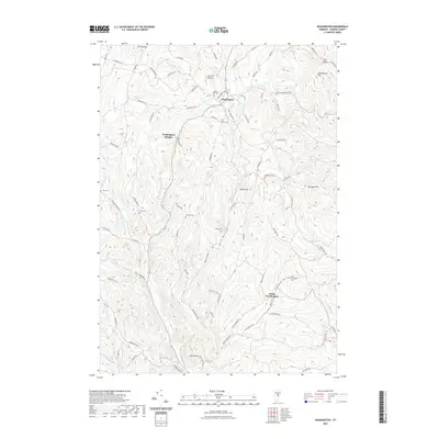
2021 Map of Washington
USGS Topo · Published 2021About this map
Washington serves as the central hub of this Orange County upland, where the village and Washington Heights are situated among the headwaters of several Vermont drainage systems. The landscape is defined by its deep hollows and high points, including Mt Pleasant, Boyce Hill, and the dramatic notch at The Notch. A remarkably high density of small burial grounds is scattered across the township, suggesting a pattern of early family settlements and long-standing community centers. Genealogists can find locations for the Cheney, Bohonon, Caswell, and Clough cemeteries, many of which are tucked away on rural routes like Pepper Rd and Jail House Rd. Modern additions such as Carriers Skypark sit alongside traditional place names like Devils Den and Bear Foot Hollow, illustrating the continuity and evolution of this rural landscape into the 21st century.
Find a feature on this map
86 named features on this map. Tap any name to fly to it.
Don’t see what you’re looking for? This feature index may not catch every label — zoom into the map to look around manually.
Map Details
Editions of this 2021 Washington Map
This is the sole edition of this map. No revisions or reprints were ever made.
Other maps of this area

1896 · Strafford
USGS Topo · 1:62,500

1919 · Royalton
USGS Topo · 1:62,500

1922 · Barre
USGS Topo · 1:48,000

1924 · Barre
USGS Topo · 1:62,500

1924 · Randolph
USGS Topo · 1:48,000

1926 · Randolph
USGS Topo · 1:62,500

1944 · Strafford
USGS Topo · 1:62,500

1947 · Corinth
USGS Topo · 1:62,500

1948 · East Barre
USGS Topo · 1:62,500

1950 · Glens Falls
USGS Topo · 1:250,000