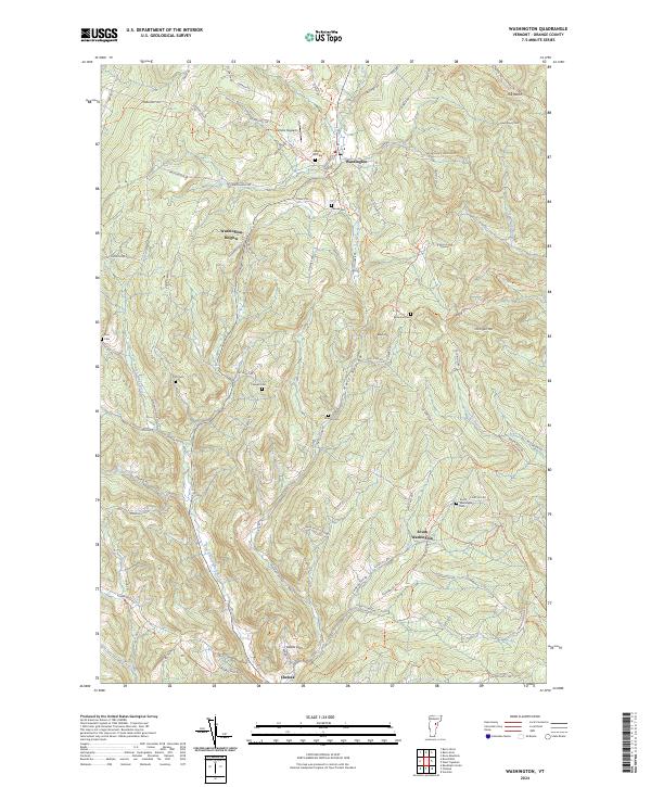
2024 Map of Washington
USGS Topo · Published 2024About this map
Washington serves as the central hub of this Orange County landscape, where the Jail Branch waterway meets a network of local thoroughfares like Washington Rd and W Corinth Rd. The terrain is characterized by a series of prominent rises including Michigan Hill and Therriault Hill, separated by named depressions such as Hart Hollow and the evocatively named Devils Den. Genealogists will find a wealth of burial sites scattered across the township, from Maple Hill Cem near the village center to more secluded locations like Caswell Cem and Bohonon Cem. The presence of Carriers Skypark and settlements like Washington Heights and South Washington illustrate the community's spread across the upland plateaus and valleys. The drainage patterns of the First Branch White River and Cookville Brook further define the layout of rural homesteads and agricultural tracts in this classic Vermont setting.
Find a feature on this map
84 named features on this map. Tap any name to fly to it.
Don’t see what you’re looking for? This feature index may not catch every label — zoom into the map to look around manually.
Map Details
Editions of this 2024 Washington Map
This is the sole edition of this map. No revisions or reprints were ever made.
Other maps of this area

1896 · Strafford
USGS Topo · 1:62,500

1919 · Royalton
USGS Topo · 1:62,500

1922 · Barre
USGS Topo · 1:48,000

1924 · Barre
USGS Topo · 1:62,500

1924 · Randolph
USGS Topo · 1:48,000

1926 · Randolph
USGS Topo · 1:62,500

1944 · Strafford
USGS Topo · 1:62,500

1947 · Corinth
USGS Topo · 1:62,500

1948 · East Barre
USGS Topo · 1:62,500

1950 · Glens Falls
USGS Topo · 1:250,000