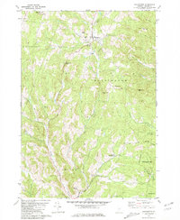
1981 Map of Washington
USGS Topo · Published 1981About this map
Washington serves as the central hub for this portion of Orange County, where the Jail Branch flows through a narrow valley bordered by steep hillsides. The landscape is defined by its rural cemetery network, including Maple Hill Cem, Cheney Cem, and Bohonon Cem, which are often located near small clusters of settlement such as Washington Heights and South Washington. These scattered hamlets and family-named landmarks like Kennedy Corners reflect the long-standing agricultural and forestry traditions of central Vermont.
Find a feature on this map
36 named features on this map. Tap any name to fly to it.
Don’t see what you’re looking for? This feature index may not catch every label — zoom into the map to look around manually.
Map Details
Editions of this 1981 Washington Map
2 editions found
Other maps of this area

1896 · Strafford
USGS Topo · 1:62,500

1919 · Royalton
USGS Topo · 1:62,500

1922 · Barre
USGS Topo · 1:48,000

1924 · Barre
USGS Topo · 1:62,500

1924 · Randolph
USGS Topo · 1:48,000

1926 · Randolph
USGS Topo · 1:62,500

1944 · Strafford
USGS Topo · 1:62,500

1947 · Corinth
USGS Topo · 1:62,500

1948 · East Barre
USGS Topo · 1:62,500

1950 · Glens Falls
USGS Topo · 1:250,000