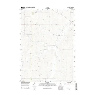
2014 Map of Waterbury
USGS Topo · Published 2014About this map
The border of Dixon Co and Dakota Co divides this rural landscape, which is defined by the dendritic drainage patterns of Elk Cr and its numerous tributaries. Small village centers like Waterbury and Goodwin anchor the local road network, while Willis sits further east along the Us-20 corridor. The terrain is deeply dissected by several named waterways, including Otter Cr and Minnow Cr, which flow toward the Heeney Reservoir in the central portion of the quadrangle.
Find a feature on this map
39 named features on this map. Tap any name to fly to it.
Don’t see what you’re looking for? This feature index may not catch every label — zoom into the map to look around manually.
Map Details
Editions of this 2014 Waterbury Map
This is the sole edition of this map. No revisions or reprints were ever made.
Other maps of this area

1898 · Elk Point
USGS Topo · 1:125,000

1901 · Elk Point
USGS Topo · 1:125,000

1907 · Elk Point
USGS Topo · 1:125,000

1955 · Sioux City
USGS Topo · 1:250,000

1958 · Sioux City
USGS Topo · 1:250,000

1959 · Sioux City
USGS Topo · 1:250,000

1963 · Jefferson
USGS Topo · 1:24,000
1964 · Ponca
USGS Topo · 1:24,000
1964 · Martinsburg
USGS Topo · 1:24,000

1967 · Waterbury
USGS Topo · 1:24,000