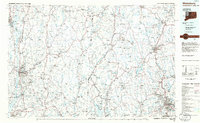
1985 Map of Waterbury
USGS Topo · Published 1986About this map
Waterbury anchors the southeastern corner of this mid-1980s regional study, where the industrial corridors of the Naugatuck River meet a landscape of extensive state forests and reservoirs. The map captures the significant hydrological development of Western Connecticut, showing the reach of the Barkhamsted Reservoir and Colebrook River Lake alongside natural landmarks like Bantam Lake. To the west, the Hudson River corridor serves as a primary boundary, linking Kingston and Poughkeepsie to the interior highlands.
Find a feature on this map
114 named features on this map. Tap any name to fly to it.
Don’t see what you’re looking for? This feature index may not catch every label — zoom into the map to look around manually.
Map Details
Editions of this 1985 Waterbury Map
This is the sole edition of this map. No revisions or reprints were ever made.
Other maps of this area

1885 · Sheffield
USGS Topo · 1:62,500

1887 · Granville
USGS Topo · 1:62,500

1888 · Sheffield
USGS Topo · 1:62,500

1888 · Sandisfield
USGS Topo · 1:62,500

1889 · Derby
USGS Topo · 1:62,500

1889 · Granville
USGS Topo · 1:62,500

1891 · Sheffield
USGS Topo · 1:62,500

1891 · Derby
USGS Topo · 1:62,500

1892 · Winsted
USGS Topo · 1:62,500

1892 · West Point
USGS Topo · 1:62,500