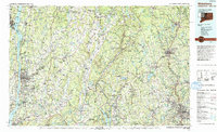
1993 Map of Waterbury
USGS Topo · Published 1993About this map
The Hudson River and the Housatonic River anchor this late-twentieth-century landscape, framing the industrial and residential corridors of Western Connecticut and Eastern New York. In Waterbury, the urban layout is defined by the Naugatuck River and central landmarks like Waterbury City Hall and Saint Marys Hospital. The map illustrates a region transitioning from its manufacturing roots to an educational and recreational hub, featuring prominent institutions such as the Taft School in Watertown and the Hotchkiss School near Lakeville.
Find a feature on this map
205 named features on this map. Tap any name to fly to it.
Don’t see what you’re looking for? This feature index may not catch every label — zoom into the map to look around manually.
Map Details
Editions of this 1993 Waterbury Map
This is the sole edition of this map. No revisions or reprints were ever made.
Other maps of this area

1885 · Sheffield
USGS Topo · 1:62,500

1887 · Granville
USGS Topo · 1:62,500

1888 · Sheffield
USGS Topo · 1:62,500

1888 · Sandisfield
USGS Topo · 1:62,500

1889 · Derby
USGS Topo · 1:62,500

1889 · Granville
USGS Topo · 1:62,500

1891 · Sheffield
USGS Topo · 1:62,500

1891 · Derby
USGS Topo · 1:62,500

1892 · Winsted
USGS Topo · 1:62,500

1892 · West Point
USGS Topo · 1:62,500