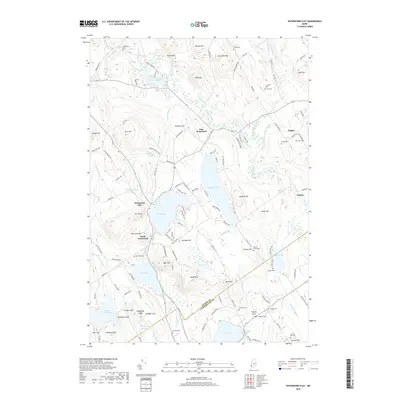
2018 Map of Waterford Flat
USGS Topo · Published 2018About this map
Waterford Flat and the surrounding highlands of western Maine are characterized by a dense concentration of family cemeteries and lakeside settlements. The landscape is defined by the basins of Keoka Lake, McWain Pond, and Bear Pond, which are separated by prominent elevations like Bear Mtn and Mt Tire'm. The map records a distinct pattern of historical land use, with many small burial grounds such as Bisbeetown Cem and the Nelson Family Plot located near the old farmsteads they once served.
Find a feature on this map
147 named features on this map. Tap any name to fly to it.
Don’t see what you’re looking for? This feature index may not catch every label — zoom into the map to look around manually.
Map Details
Editions of this 2018 Waterford Flat Map
This is the sole edition of this map. No revisions or reprints were ever made.
Other maps of this area

1896 · Norway
USGS Topo · 1:62,500

1909 · Fryeburg
USGS Topo · 1:62,500

1911 · Fryeburg
USGS Topo · 1:62,500

1911 · Bryant Pond
USGS Topo · 1:62,500

1914 · Bethel
USGS Topo · 1:62,500

1914 · Bryant Pond
USGS Topo · 1:62,500

1940 · Bethel
USGS Topo · 1:62,500

1941 · Bethel
USGS Topo · 1:62,500

1941 · Fryeburg
USGS Topo · 1:62,500

1942 · Bryant Pond
USGS Topo · 1:62,500