
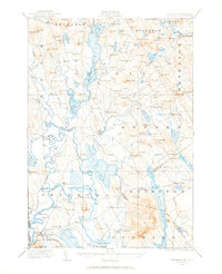
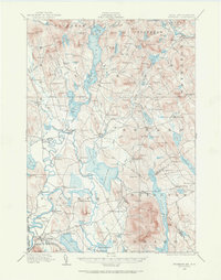
1909 Map of Fryeburg
USGS Topo · Published 1960About this map
The Saco River and its intricate hydrological history dominate this early 20th-century landscape along the Maine and New Hampshire border. The map clearly delineates the Old Course Saco River, illustrating how the waterway shifted over time, leaving behind a network of oxbows and intervale lands near North Fryeburg and Fryeburg Center. Settlement is clustered around these fertile plains and the various bays of Kezar Lake, where places like Center Lovell and Slab City served local timber and agricultural interests.
Find a feature on this map
194 named features on this map. Tap any name to fly to it.
Don’t see what you’re looking for? This feature index may not catch every label — zoom into the map to look around manually.
Map Details
Editions of this 1909 Fryeburg Map
3 editions found
Other maps of this area

1893 · Gorham
USGS Topo · 1:62,500

1894 · North Conway
USGS Topo · 1:62,500

1896 · Norway
USGS Topo · 1:62,500

1896 · Sebago
USGS Topo · 1:62,500

1896 · North Conway
USGS Topo · 1:62,500

1896 · Gorham
USGS Topo · 1:62,500

1910 · Kezar Falls
USGS Topo · 1:48,000

1911 · Fryeburg
USGS Topo · 1:62,500

1911 · Kezar Falls
USGS Topo · 1:62,500

1911 · Bryant Pond
USGS Topo · 1:62,500