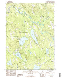
1983 Map of Waterford Flat
USGS Topo · Published 1984About this map
The Crooked River meanders through the central Oxford County landscape, defining a region where glacial geology and recreational history meet. In the early 1980s, this area centered on Waterford Flat and East Waterford remained characterized by its dense concentration of named hills and large glacial lakes, including Keoka Lake and the elongated Mc Wain Pond. The settlement pattern follows the valley floors, with small clusters like South Waterford and the curiously named Sodom situated near the water's edge. Numerous summer camps, such as Camp Waziyatah and Camp Wigwam, illustrate the long-standing tradition of lakefront retreats in the Maine woods.
Find a feature on this map
79 named features on this map. Tap any name to fly to it.
Don’t see what you’re looking for? This feature index may not catch every label — zoom into the map to look around manually.
Map Details
Editions of this 1983 Waterford Flat Map
This is the sole edition of this map. No revisions or reprints were ever made.
Other maps of this area

1896 · Norway
USGS Topo · 1:62,500

1909 · Fryeburg
USGS Topo · 1:62,500

1911 · Fryeburg
USGS Topo · 1:62,500

1911 · Bryant Pond
USGS Topo · 1:62,500

1914 · Bethel
USGS Topo · 1:62,500

1914 · Bryant Pond
USGS Topo · 1:62,500

1940 · Bethel
USGS Topo · 1:62,500

1941 · Bethel
USGS Topo · 1:62,500

1941 · Fryeburg
USGS Topo · 1:62,500

1942 · Bryant Pond
USGS Topo · 1:62,500