2022 Map of Waterford
USGS Topo · Published 2022About this map
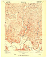
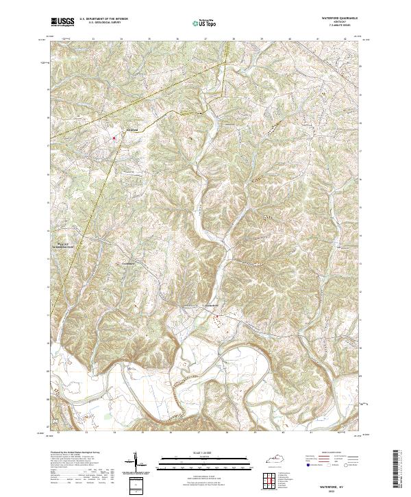
The Salt River carves a winding path through this portion of Spencer and Bullitt counties, anchoring a landscape defined by the convergence of several major drainages. Near the center of the sheet, the village of Waterford sits at the junction of Plum Creek and the river, a historic focal point for local commerce and transport. The terrain is deeply dissected by numerous runs and creeks, including Broad Run, Wheelers Run, and Brush Run in the north, creating a complex series of ridges and hollows like the curiously named Feather Bed Hollow.
Find a feature on this map
104 named features on this map. Tap any name to fly to it.
Don’t see what you’re looking for? This feature index may not catch every label — zoom into the map to look around manually.
Map Details
Editions of this 2022 Waterford Map
This is the sole edition of this map. No revisions or reprints were ever made.
Historical Maps of Mount Washington Through Time
6 maps found