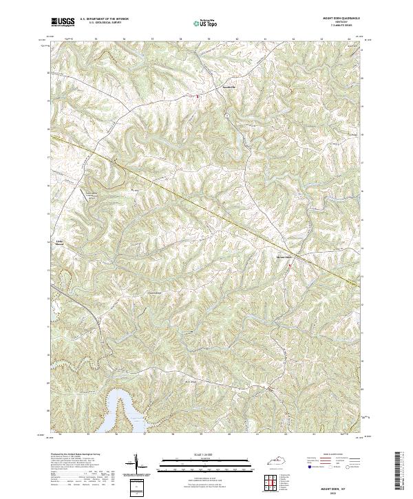
2022 Map of Mount Eden
USGS Topo · Published 2022About this map
Mount Eden and Southville anchor this Kentucky landscape where the upland ridges of Spencer County meet the northern reaches of Taylorsville Lake. The terrain is defined by a dense network of winding drainage systems, including Beech Creek and Tenmile Creek, which have carved deep valleys through the limestone-rich topography. Higher ground is marked by locally named elevations such as Elk Hill and the broad expanses of Possum Ridge and Pea Ridge.
Find a feature on this map
71 named features on this map. Tap any name to fly to it.
Don’t see what you’re looking for? This feature index may not catch every label — zoom into the map to look around manually.
Map Details
Editions of this 2022 Mount Eden Map
This is the sole edition of this map. No revisions or reprints were ever made.
Other maps of this area

1923 · Waddy
USGS Topo · 1:48,000

1925 · Mount Eden
USGS Topo · 1:48,000

1927 · Mount Eden
USGS Topo · 1:62,500

1929 · Taylorsville
USGS Topo · 1:62,500

1952 · Ashbrook
USGS Topo · 1:24,000

1952 · Chaplin
USGS Topo · 1:24,000

1953 · Bloomfield
USGS Topo · 1:24,000
1954 · Glensboro
USGS Topo · 1:24,000

1954 · Taylorsville
USGS Topo · 1:24,000
1954 · Waddy
USGS Topo · 1:24,000