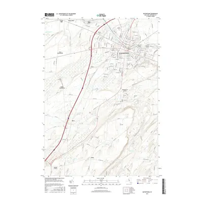
2016 Map of Watertown
USGS Topo · Published 2016About this map
The Black River serves as the central artery for this portion of Jefferson County, dividing the urban center of Watertown and carving past Beebee's Island and Sewalls Island. This landscape reflects a dense history of industry and community, with the river's path connecting the villages of Glen Park and Brownville to the west. The area is marked by several notable burial grounds, including Arsenal Street Cem and the extensive Brookside Cem, which offer significant genealogical value for those tracing local lineages.
Find a feature on this map
149 named features on this map. Tap any name to fly to it.
Don’t see what you’re looking for? This feature index may not catch every label — zoom into the map to look around manually.
Map Details
Editions of this 2016 Watertown Map
This is the sole edition of this map. No revisions or reprints were ever made.
Other maps of this area

1893 · Sackets Harbor
USGS Topo · 1:62,500

1895 · Sacketts Harbor
USGS Topo · 1:62,500

1895 · Watertown
USGS Topo · 1:62,500

1898 · Watertown
USGS Topo · 1:62,500

1900 · Clayton
USGS Topo · 1:62,500

1903 · Clayton
USGS Topo · 1:62,500

1903 · Theresa
USGS Topo · 1:62,500

1908 · Watertown
USGS Topo · 1:62,500

1909 · Watertown
USGS Topo · 1:62,500
1943 · Sackets Harbor
USGS Topo · 1:31,680