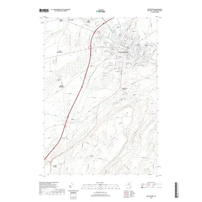
2019 Map of Watertown
USGS Topo · Published 2019About this map
The Black River bisects the northern reaches of this Jefferson County landscape, winding past industrial and urban centers where Sewalls Island and Diamond Island divide its current. The city of Watertown serves as the focal point, characterized by a dense grid of residential streets and commercial corridors like Stateway Plz. Moving south, the terrain rises toward Dry Hill, transitioning from the urban core into a network of smaller communities including Watertown Center, Rices, and Dillen. Genealogists will find a wealth of burial records preserved across the region, from the large North Watertown Cem and Glenwood Cem to smaller sites like Fields Settlement Cem and Degel Israel Cem. The landscape is further defined by natural features such as Talcott Falls and the creek beds of Stony Cr and N Br Sandy Cr that carve through the southern agricultural lands.
Find a feature on this map
151 named features on this map. Tap any name to fly to it.
Don’t see what you’re looking for? This feature index may not catch every label — zoom into the map to look around manually.
Map Details
Editions of this 2019 Watertown Map
This is the sole edition of this map. No revisions or reprints were ever made.
Other maps of this area

1893 · Sackets Harbor
USGS Topo · 1:62,500

1895 · Sacketts Harbor
USGS Topo · 1:62,500

1895 · Watertown
USGS Topo · 1:62,500

1898 · Watertown
USGS Topo · 1:62,500

1900 · Clayton
USGS Topo · 1:62,500

1903 · Clayton
USGS Topo · 1:62,500

1903 · Theresa
USGS Topo · 1:62,500

1908 · Watertown
USGS Topo · 1:62,500

1909 · Watertown
USGS Topo · 1:62,500
1943 · Sackets Harbor
USGS Topo · 1:31,680