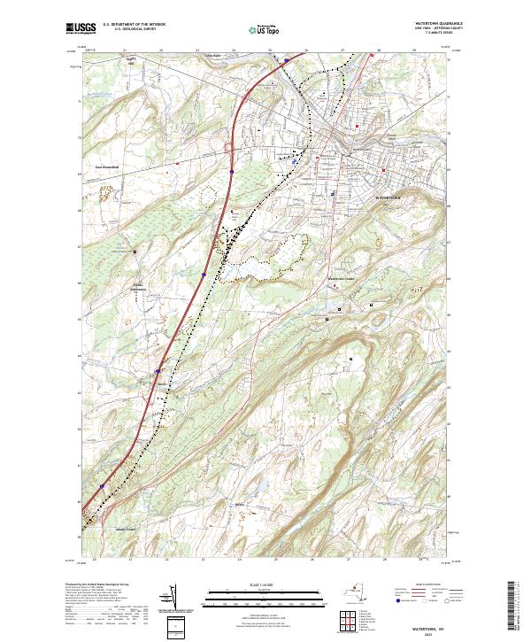
2023 Map of Watertown
USGS Topo · Published 2023About this map
The Black River defines the urban core of Watertown, driving its industrial development and shaping its geography with features like Beebee's Island and Sewalls Island. This modern survey reveals a landscape where the dense grid of the city, marked by the Jefferson County Court Complex and Thompson Park, transitions into the more dispersed hamlets of East Hounsfield and Fields Settlement.
Find a feature on this map
157 named features on this map. Tap any name to fly to it.
Don’t see what you’re looking for? This feature index may not catch every label — zoom into the map to look around manually.
Map Details
Editions of this 2023 Watertown Map
This is the sole edition of this map. No revisions or reprints were ever made.
Other maps of this area

1893 · Sackets Harbor
USGS Topo · 1:62,500

1895 · Sacketts Harbor
USGS Topo · 1:62,500

1895 · Watertown
USGS Topo · 1:62,500

1898 · Watertown
USGS Topo · 1:62,500

1900 · Clayton
USGS Topo · 1:62,500

1903 · Clayton
USGS Topo · 1:62,500

1903 · Theresa
USGS Topo · 1:62,500

1908 · Watertown
USGS Topo · 1:62,500

1909 · Watertown
USGS Topo · 1:62,500
1943 · Sackets Harbor
USGS Topo · 1:31,680