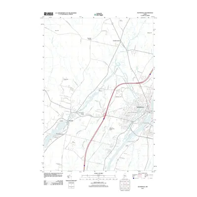
2011 Map of Waterville
USGS Topo · Published 2011About this map
Industrial and geographic landmarks define the Kennebec River valley in this 2011 survey of Waterville and its surroundings. The river's hydraulic power is evidenced by a series of installations including the Fort Halifax Dam and the Milstar Dam, while the Messalonskee Stream adds to the region's complex water network with the Rice Rips Dam and Messalonskee Number 2 Dam. To the west, the town of Oakland sits at the edge of the Snow Pond Dam, serving as a hub for both terrestrial and aquatic transit, including the Moody Snow Pond Seaplane Base. High ground like Mayflower Hill and Hussey Hill overlooks a landscape marked by legacy sites for genealogists, such as the Drummond Cemetery, Lakeview Cemetery, and Tozier Cemetery.
Find a feature on this map
104 named features on this map. Tap any name to fly to it.
Don’t see what you’re looking for? This feature index may not catch every label — zoom into the map to look around manually.
Map Details
Editions of this 2011 Waterville Map
This is the sole edition of this map. No revisions or reprints were ever made.
Other maps of this area

1892 · Waterville
USGS Topo · 1:62,500

1892 · Augusta
USGS Topo · 1:62,500

1893 · Vassalboro
USGS Topo · 1:62,500

1894 · Norridgewock
USGS Topo · 1:62,500

1898 · Norridgewock
USGS Topo · 1:62,500

1898 · Vassalboro
USGS Topo · 1:62,500

1941 · Vassalboro
USGS Topo · 1:62,500

1941 · Augusta
USGS Topo · 1:62,500

1943 · Augusta
USGS Topo · 1:62,500

1943 · Vassalboro
USGS Topo · 1:62,500