
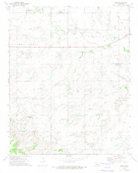
1972 Map of Watonga SE
USGS Topo · Published 1974About this map
The North Canadian River cuts through the southwestern corner of this Oklahoma landscape, anchoring a terrain defined by the broad Cedar Valley. In the early 1970s, the area's economic character was heavily shaped by energy infrastructure, evidenced by a dense network of Gas Wells, Oil Wells, and several segments of Pipeline traversing the hills. This 1972 survey by the U.S. Geological Survey reveals a rural layout where the townships of Watonga and Lincoln meet. Local history is anchored by several small burial grounds, including Evergreen Cem in the north and Eudora Cem in the southeast. The map provides a precise record of the land just before modern agricultural and energy development further altered the drainage patterns and township lines in this portion of Blaine County.
Find a feature on this map
12 named features on this map. Tap any name to fly to it.
Don’t see what you’re looking for? This feature index may not catch every label — zoom into the map to look around manually.
Map Details
Editions of this 1972 Watonga SE Map
This is the sole edition of this map. No revisions or reprints were ever made.
Other maps of this area

1893 · Fort Reno
USGS Topo · 1:62,500

1893 · Loyal
USGS Topo · 1:62,500

1941 · Fort Reno
USGS Topo · 1:62,500

1942 · Fort Reno
USGS Topo · 1:62,500

1942 · Geary
USGS Topo · 1:62,500

1949 · Fort Reno
USGS Topo · 1:62,500

1955 · Clinton
USGS Topo · 1:250,000

1957 · Clinton
USGS Topo · 1:250,000

1972 · Watonga
USGS Topo · 1:24,000
1972 · Omega
USGS Topo · 1:24,000