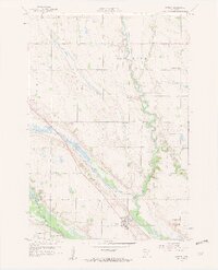
1958 Map of Watson
USGS Topo · Published 1959About this map
Watson stands at the intersection of a complex riverine landscape where the Chippewa River meanders sharply through the Big Bend before joining the Minnesota River valley. This 1950s landscape is defined by the Watson Sag, a prominent geological feature traced by the Chicago Milwaukee St Paul and Pacific railroad. The settlement pattern reflects a deeply established rural community, evidenced by a high density of one-room schoolhouses like School No 288 and School No 276, alongside local spiritual centers such as Zion Ch and Immanuel Ch. Historical preservation is already evident in the late fifties at the Lac qui Parle Mission Park and the state monument at Camp Release, which commemorate the area's frontier history and early missionary efforts near the Churchill settlement and the Tunsberg Levee.
Find a feature on this map
28 named features on this map. Tap any name to fly to it.
Don’t see what you’re looking for? This feature index may not catch every label — zoom into the map to look around manually.
Map Details
Editions of this 1958 Watson Map
3 editions found
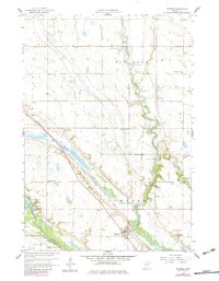
Other maps of this area

1953 · New Ulm
USGS Topo · 1:250,000

1953 · Saint Cloud
USGS Topo · 1:250,000

1957 · Saint Cloud
USGS Topo · 1:250,000

1957 · New Ulm
USGS Topo · 1:250,000

1958 · New Ulm
USGS Topo · 1:250,000

1958 · Saint Cloud
USGS Topo · 1:250,000

1958 · Milan
USGS Topo · 1:24,000

1958 · Big Bend City
USGS Topo · 1:24,000

1958 · Watson
USGS Topo · 1:24,000

1958 · Milan NW
USGS Topo · 1:24,000