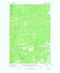
1963 Map of Watson
USGS Topo · Published 1964About this map
The Escanaba and Lake Superior railroad cuts through the heart of this central Upper Peninsula landscape, connecting the small settlement of Watson to the surrounding timberlands. To the south, the Forest Home Cem and a local Townhall serve as focal points for the dispersed community, while the Chicago and North Western line skirts the eastern edge near Helena. This mid-century survey reveals a region defined by its water and industrial potential, from the Gardner Mine in the north to numerous Gravel Pits scattered throughout the Escanaba River State Forest. The geography is intricately carved by the West Branch Escanaba River and its many tributaries, including Chynes Creek and Lindsey Creek, while the Arnold Lookout Tower stands as a silent sentinel over the vast stretches of forest and swamp.
Find a feature on this map
48 named features on this map. Tap any name to fly to it.
Don’t see what you’re looking for? This feature index may not catch every label — zoom into the map to look around manually.
Map Details
Editions of this 1963 Watson Map
This is the sole edition of this map. No revisions or reprints were ever made.
Other maps of this area

1932 · Skandia SW
USGS Topo · 1:31,680

1932 · Rock SW
USGS Topo · 1:31,680

1932 · Helena NW
USGS Topo · 1:31,680

1932 · Helena NE
USGS Topo · 1:31,680

1932 · Whitney NE
USGS Topo · 1:31,680

1932 · Harvey SE
USGS Topo · 1:31,680

1932 · Harvey SW
USGS Topo · 1:31,680

1932 · Helena SW
USGS Topo · 1:31,680

1932 · Rock NW
USGS Topo · 1:31,680

1932 · Helena
USGS Topo · 1:31,680