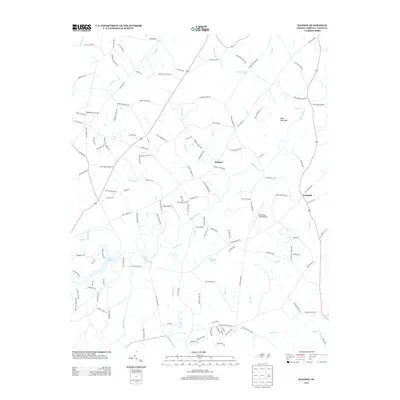
2013 Map of Watson
USGS Topo · Published 2013About this map
Watson and the surrounding Union County countryside are defined by a complex network of creeks and branches that drain the Piedmont landscape toward the south and east. Significant water bodies like Lake Twitty and Brewer Lake anchor the central and western sections, while the prominent height of Polk Mountain rises in the northeast corner. The map documents an area characterized by family-named roads and agrarian legacies, such as Haigler Gin Rd and Piedmont School Rd, which hint at the rural infrastructure of previous generations. Transportation and small-scale aviation are represented by facilities like Arant Airport and Mc Donald Field Airport, situated among the winding courses of Richardson Cr and its many tributaries. The settlement of Fairfield sits along the eastern corridor, where the land begins to level out toward Salem Cr.
Find a feature on this map
130 named features on this map. Tap any name to fly to it.
Don’t see what you’re looking for? This feature index may not catch every label — zoom into the map to look around manually.
Map Details
Editions of this 2013 Watson Map
This is the sole edition of this map. No revisions or reprints were ever made.
Other maps of this area

1941 · Charlotte
USGS Topo · 1:125,000

1941 · Spartanburg
USGS Topo · 1:250,000

1942 · Charlotte
USGS Topo · 1:125,000

1949 · Midland
USGS Topo · 1:24,000

1953 · Spartanburg
USGS Topo · 1:250,000

1953 · Charlotte
USGS Topo · 1:250,000

1954 · Charlotte
USGS Topo · 1:250,000

1960 · Charlotte
USGS Topo · 1:250,000

1960 · Spartanburg
USGS Topo · 1:250,000

1962 · Charlotte
USGS Topo · 1:250,000