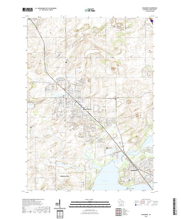
2022 Map of Waunakee
USGS Topo · Published 2022About this map
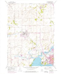
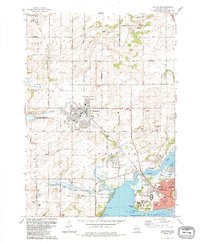
Waunakee serves as the central hub of this modern survey, where suburban growth meets the persistent hydrology of the Waunakee Marsh. The landscape is defined by the winding course of Sixmile Creek and Dorn Creek, which flow toward the northern shores of Lake Mendota near Farwells Point. This map captures a significant period of residential expansion extending from the northern edge of Middleton and the northwest corner of Madison, while still preserving numerous local landmarks for family historians.
Find a feature on this map
172 named features on this map. Tap any name to fly to it.
Don’t see what you’re looking for? This feature index may not catch every label — zoom into the map to look around manually.
Map Details
Editions of this 2022 Waunakee Map
This is the sole edition of this map. No revisions or reprints were ever made.