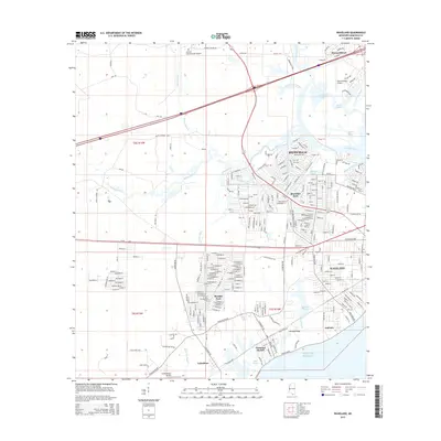
2015 Map of Waveland
USGS Topo · Published 2015About this map
Waveland and Bay St Louis anchor this coastal landscape, showing the dense residential grid of the Mississippi sound just years after modern redevelopment transformed the shoreline. To the north, the planned community of Diamondhead is characterized by winding suburban lanes like Noma Dr and Alapai Dr, contrasting sharply with the rectangular blocks of Shoreline Park and Bayside Park. This region is defined by its complex hydrology, where the Jourdan River meets a network of smaller channels including Edwards Bayou and Breath Bayou. The map illustrates a landscape of coastal marshes and ridges, notably Jackson Ridge and the Jackson Marsh, while aviation infrastructure at Stennis International Airport and Diamondhead Airport marks the area's modern transit role. Further west, smaller coastal settlements like Clermont Harbor and Lakeshore line the edge of the Gulf of Mexico.
Find a feature on this map
264 named features on this map. Tap any name to fly to it.
Don’t see what you’re looking for? This feature index may not catch every label — zoom into the map to look around manually.
Map Details
Editions of this 2015 Waveland Map
This is the sole edition of this map. No revisions or reprints were ever made.
Other maps of this area

1893 · Rigolets
USGS Topo · 1:62,500

1893 · Toulme
USGS Topo · 1:62,500

1914 · Nicholson
USGS Topo · 1:62,500

1921 · Nicholson
USGS Topo · 1:62,500

1935 · English Lookout
USGS Topo · 1:31,680

1935 · Grand Island Pass
USGS Topo · 1:31,680

1936 · Rigolets
USGS Topo · 1:62,500

1949 · Grand Island Pass
USGS Topo · 1:31,680

1953 · Mobile
USGS Topo · 1:250,000
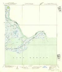
1954 · English Lookout
USGS Topo · 1:31,680