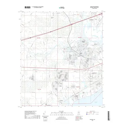
2018 Map of Waveland
USGS Topo · Published 2018About this map
The coastal marshlands and residential developments of Hancock County meet the Mississippi Sound in this detailed 2018 survey. The landscape is defined by an intricate network of waterways, including the Jourdan River, Bayou La Croix, and Bayou Lacroix, which thread through the low-lying terrain. To the north, the planned community of Diamondhead is established alongside the Stennis International Airport, while the southern shoreline is anchored by the historic coastal settlements of Waveland and Bay St. Louis. The map reveals the dense street grids of Shoreline Park and Bayside Park, illustrating the mid-to-late 20th-century expansion of these waterfront communities. Significant natural features like the Jackson Marsh and Mud Bayou underscore the delicate balance between residential development and the surrounding gulf ecosystems, while smaller landing strips such as Turkey Bayou Airpark and Diamondhead Airport highlight the area's specialized transportation infrastructure.
Find a feature on this map
281 named features on this map. Tap any name to fly to it.
Don’t see what you’re looking for? This feature index may not catch every label — zoom into the map to look around manually.
Map Details
Editions of this 2018 Waveland Map
This is the sole edition of this map. No revisions or reprints were ever made.
Other maps of this area

1893 · Rigolets
USGS Topo · 1:62,500

1893 · Toulme
USGS Topo · 1:62,500

1914 · Nicholson
USGS Topo · 1:62,500

1921 · Nicholson
USGS Topo · 1:62,500

1935 · English Lookout
USGS Topo · 1:31,680

1935 · Grand Island Pass
USGS Topo · 1:31,680

1936 · Rigolets
USGS Topo · 1:62,500

1949 · Grand Island Pass
USGS Topo · 1:31,680

1953 · Mobile
USGS Topo · 1:250,000
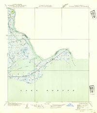
1954 · English Lookout
USGS Topo · 1:31,680