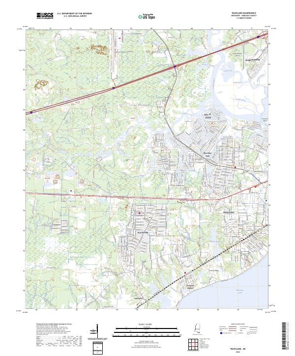
2024 Map of Waveland
USGS Topo · Published 2024About this map
The coastal communities of Waveland and Bay St. Louis are detailed in this contemporary look at Hancock County, where the intricate network of water defines the landscape. The Jourdan River snakes toward the Mississippi Sound, bordered by complex wetlands like Jackson Marsh and the tidal channels of Mud Bayou and Grand Bayou. These natural features intersect with established residential centers such as Shoreline Park and Bayside Park, illustrating the region's long-standing relationship with its maritime environment. To the north, the modern infrastructure of Stennis International Airport and the planned community of Diamondhead mark the expansion of the area beyond the historic shoreline. Local history is traced through the grid of Lakeshore and the bay-side streets of Clermont Harbor, providing a thorough view of the region's current geography.
Find a feature on this map
279 named features on this map. Tap any name to fly to it.
Don’t see what you’re looking for? This feature index may not catch every label — zoom into the map to look around manually.
Map Details
Editions of this 2024 Waveland Map
This is the sole edition of this map. No revisions or reprints were ever made.
Other maps of this area

1893 · Rigolets
USGS Topo · 1:62,500

1893 · Toulme
USGS Topo · 1:62,500

1914 · Nicholson
USGS Topo · 1:62,500

1921 · Nicholson
USGS Topo · 1:62,500

1935 · English Lookout
USGS Topo · 1:31,680

1935 · Grand Island Pass
USGS Topo · 1:31,680

1936 · Rigolets
USGS Topo · 1:62,500

1949 · Grand Island Pass
USGS Topo · 1:31,680

1953 · Mobile
USGS Topo · 1:250,000
1954 · English Lookout
USGS Topo · 1:31,680