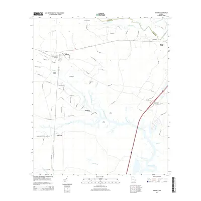
2014 Map of Waverly
USGS Topo · Published 2014About this map
Waverly and White Oak anchor this low-lying coastal landscape where the Glynn Co / Camden Co line meets the winding Little Satilla River. The terrain is a complex network of wetlands and riverine reaches, defined by substantial islands like Still Island, Hull Island, and Goat Island that rise from the surrounding marshes. A mix of rural development and family history is evident in the proximity of Horse Stamp Cem and Quarterman Cem to the modern corridors of Us-17 and Ga-110. The presence of the Hazzards Neck Lookout Tower near the Interstate 95 corridor provides a distinct navigational landmark amidst the intricate drainage of Quarterman Cr and White Oak Creek. This topography reflects the transitional nature of the Georgia coast, where established settlements like Spring Bluff and Red Bluff occupy slightly higher ground overlooking tidal creeks such as Waverly Cr and Sweeny Cr.
Find a feature on this map
88 named features on this map. Tap any name to fly to it.
Don’t see what you’re looking for? This feature index may not catch every label — zoom into the map to look around manually.
Map Details
Editions of this 2014 Waverly Map
This is the sole edition of this map. No revisions or reprints were ever made.
Other maps of this area

1917 · Nahunta
USGS Topo · 1:62,500

1917 · Boulogne
USGS Topo · 1:62,500

1918 · Nahunta
USGS Topo · 1:62,500

1918 · Bladen
USGS Topo · 1:62,500

1918 · Kingsland
USGS Topo · 1:62,500

1919 · Boulogne
USGS Topo · 1:62,500

1939 · Bladen
USGS Topo · 1:62,500

1946 · Brunswick
USGS Topo · 1:250,000

1948 · Jacksonville
USGS Topo · 1:250,000

1948 · Brunswick
USGS Topo · 1:250,000