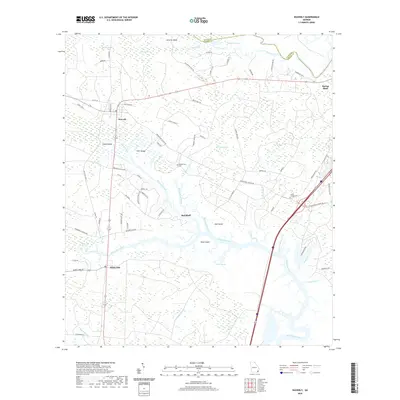
2020 Map of Waverly
USGS Topo · Published 2020About this map
The Little Satilla River and White Oak Creek define the low-lying coastal landscape of Camden and Glynn Counties in this modern topographic study. The settlement of Waverly sits at the intersection of Old Dixie Hwy and local routes, surrounded by a complex network of wetlands including Tiger Swamp, Glencoe Swamp, and Hayner Swamp. The map details the transition from dry land to the extensive salt marshes and tidal creeks that separate inland pine forests from the Atlantic coast.
Find a feature on this map
78 named features on this map. Tap any name to fly to it.
Don’t see what you’re looking for? This feature index may not catch every label — zoom into the map to look around manually.
Map Details
Editions of this 2020 Waverly Map
This is the sole edition of this map. No revisions or reprints were ever made.
Other maps of this area

1917 · Nahunta
USGS Topo · 1:62,500

1917 · Boulogne
USGS Topo · 1:62,500

1918 · Nahunta
USGS Topo · 1:62,500

1918 · Bladen
USGS Topo · 1:62,500

1918 · Kingsland
USGS Topo · 1:62,500

1919 · Boulogne
USGS Topo · 1:62,500

1939 · Bladen
USGS Topo · 1:62,500

1946 · Brunswick
USGS Topo · 1:250,000

1948 · Jacksonville
USGS Topo · 1:250,000

1948 · Brunswick
USGS Topo · 1:250,000