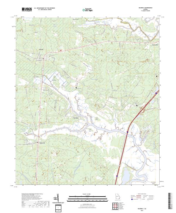
2024 Map of Waverly
USGS Topo · Published 2024About this map
Waverly and White Oak anchor this corner of coastal Georgia, where the land dissolves into a complex network of waterways and low-lying islands. Modern transport corridors, including the Old Dixie Hwy, cut through a landscape defined by names that speak to its deep agricultural and natural history, such as Magnolia Plantation and Canoe Swamp. The hydrology is particularly intricate, with the Little Satilla River to the north and White Oak Creek to the south framing a series of wetlands like Tiger Swamp and Barkers Swamp. For local historians, the presence of family-named burial grounds including Quarterman Cem and Horse Stamp Cem provides specific points for genealogical mapping. The transition from established settlements to the tidal reaches of Horseshoe Cove and Crow Harbor Island illustrates the geographic character of the lower Atlantic coastal plain.
Find a feature on this map
78 named features on this map. Tap any name to fly to it.
Don’t see what you’re looking for? This feature index may not catch every label — zoom into the map to look around manually.
Map Details
Editions of this 2024 Waverly Map
This is the sole edition of this map. No revisions or reprints were ever made.
Other maps of this area

1917 · Nahunta
USGS Topo · 1:62,500

1917 · Boulogne
USGS Topo · 1:62,500

1918 · Nahunta
USGS Topo · 1:62,500

1918 · Bladen
USGS Topo · 1:62,500

1918 · Kingsland
USGS Topo · 1:62,500

1919 · Boulogne
USGS Topo · 1:62,500

1939 · Bladen
USGS Topo · 1:62,500

1946 · Brunswick
USGS Topo · 1:250,000

1948 · Jacksonville
USGS Topo · 1:250,000

1948 · Brunswick
USGS Topo · 1:250,000