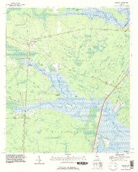
1993 Map of Waverly
USGS Topo · Published 1995About this map
The Little Satilla River and White Oak Creek carve through the coastal lowlands of Camden and Glynn counties, defining a landscape dominated by expansive wetlands and named hammocks. In the early 1990s, the settlements of Waverly and White Oak remained established along the corridor of the Old Dixie Highway. The map reveals a community connected by faith and family history, evidenced by several rural congregations including Mt Oran Ch, Rising Daughter Ch, and Horse Stamp Ch. Distinctive land features such as Hazzards Neck and Wild Neck are separated by intricate swamp systems like Canoe Swamp and Tower Swamp. To the north, The Dike and Gowrie Island sit amidst the river's path, while legacy landmarks like Quarterman Cem provide essential data points for local genealogists tracing long-standing coastal families.
Find a feature on this map
45 named features on this map. Tap any name to fly to it.
Don’t see what you’re looking for? This feature index may not catch every label — zoom into the map to look around manually.
Map Details
Editions of this 1993 Waverly Map
This is the sole edition of this map. No revisions or reprints were ever made.
Other maps of this area

1917 · Nahunta
USGS Topo · 1:62,500

1917 · Boulogne
USGS Topo · 1:62,500

1918 · Nahunta
USGS Topo · 1:62,500

1918 · Bladen
USGS Topo · 1:62,500

1918 · Kingsland
USGS Topo · 1:62,500

1919 · Boulogne
USGS Topo · 1:62,500

1939 · Bladen
USGS Topo · 1:62,500

1946 · Brunswick
USGS Topo · 1:250,000

1948 · Jacksonville
USGS Topo · 1:250,000

1948 · Brunswick
USGS Topo · 1:250,000