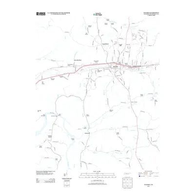
2013 Map of Waverly
USGS Topo · Published 2013About this map
The city of Waverly serves as the focal point of this Humphreys County landscape, where the CSX railroad corridor runs parallel to the winding path of Trace Creek. The terrain is defined by a dense network of named hollows and ridges, such as Negro Ridge and McKelvy Hollow, which channel numerous tributaries toward the Duck River in the southwest. This river segment is notable for its natural navigation markers, including Paint Rock Bluff and the shallow waters of Johnson Shoals.
Find a feature on this map
169 named features on this map. Tap any name to fly to it.
Don’t see what you’re looking for? This feature index may not catch every label — zoom into the map to look around manually.
Map Details
Editions of this 2013 Waverly Map
This is the sole edition of this map. No revisions or reprints were ever made.
Other maps of this area

1936 · Gorman
USGS Topo · 1:24,000

1936 · Hurricane Mills
USGS Topo · 1:24,000

1936 · Woolworth
USGS Topo · 1:24,000

1936 · Bucksnort
USGS Topo · 1:24,000

1936 · Halls Creek
USGS Topo · 1:24,000

1936 · Johnsonville
USGS Topo · 1:24,000

1936 · Harmon Creek
USGS Topo · 1:24,000

1936 · Waverly
USGS Topo · 1:24,000

1936 · Hustburg
USGS Topo · 1:24,000

1949 · Harmon Creek
USGS Topo · 1:24,000