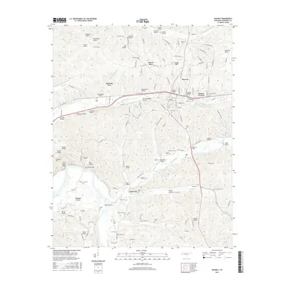
2016 Map of Waverly
USGS Topo · Published 2016About this map
Waverly sits at the heart of this Humphreys County landscape, where the transport corridor of the railroad and W Trace Creek Rd follows the winding path of Trace Creek. The terrain is defined by a dense network of named hollows, including the curiously titled Pennywinkle Hollow, Sectionhouse Hollow, and Poorhouse Hollow, suggesting the local social and industrial geography of previous generations. To the south, the land softens as it approaches the waters of the Tennessee River, marked here by Johnson Shoals and the elevated Paint Rock Bluff. The area is dotted with numerous small family burial grounds such as the Burnham Cemeteries, Harris Cem, and McAdoo Cem, providing a rich resource for genealogical research. Smaller communities like Hopkins Crossing and Elysian Grove anchor the outlying rural districts, connected by traditional routes such as Old Linden Rd and the crossing at Tubbs Ford Bridge.
Find a feature on this map
155 named features on this map. Tap any name to fly to it.
Don’t see what you’re looking for? This feature index may not catch every label — zoom into the map to look around manually.
Map Details
Editions of this 2016 Waverly Map
This is the sole edition of this map. No revisions or reprints were ever made.
Other maps of this area

1936 · Gorman
USGS Topo · 1:24,000

1936 · Hurricane Mills
USGS Topo · 1:24,000

1936 · Woolworth
USGS Topo · 1:24,000

1936 · Bucksnort
USGS Topo · 1:24,000

1936 · Halls Creek
USGS Topo · 1:24,000

1936 · Johnsonville
USGS Topo · 1:24,000

1936 · Harmon Creek
USGS Topo · 1:24,000

1936 · Waverly
USGS Topo · 1:24,000

1936 · Hustburg
USGS Topo · 1:24,000

1949 · Harmon Creek
USGS Topo · 1:24,000