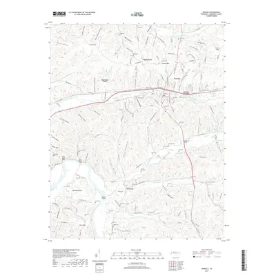
2019 Map of Waverly
USGS Topo · Published 2019About this map
Waverly serves as the central hub of this Humphreys County landscape, where the confluence of rail and road infrastructure meets a deeply dissected terrain of hollows and ridges. To the west, the Duck River snakes through the valley floor, creating landmarks like Paint Rock Bluff and Johnson Shoals. The settlement pattern follows the drainage of Trace Creek, with several small communities such as Hopkins Crossing, Forest Hill, and Pigeon Roost lining the transport corridors.
Find a feature on this map
161 named features on this map. Tap any name to fly to it.
Don’t see what you’re looking for? This feature index may not catch every label — zoom into the map to look around manually.
Map Details
Editions of this 2019 Waverly Map
This is the sole edition of this map. No revisions or reprints were ever made.
Other maps of this area

1936 · Gorman
USGS Topo · 1:24,000

1936 · Hurricane Mills
USGS Topo · 1:24,000

1936 · Woolworth
USGS Topo · 1:24,000

1936 · Bucksnort
USGS Topo · 1:24,000

1936 · Halls Creek
USGS Topo · 1:24,000

1936 · Johnsonville
USGS Topo · 1:24,000

1936 · Harmon Creek
USGS Topo · 1:24,000

1936 · Waverly
USGS Topo · 1:24,000

1936 · Hustburg
USGS Topo · 1:24,000

1949 · Harmon Creek
USGS Topo · 1:24,000