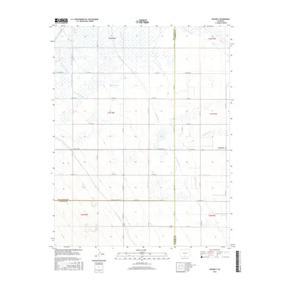
2016 Map of Waverly
USGS Topo · Published 2016About this map
The settlement of Waverly anchors this landscape, which is defined by an intricate network of irrigation infrastructure essential to high-altitude agriculture. Water management systems, including the substantial Empire Canal and the Monte Vista Canal, dominate the terrain, illustrating the region's long-standing reliance on diverted water for farming and ranching. The map reveals the precise layout of smaller-scale ditches and laterals, such as the Denver Colony Lateral, Spruce Lawn Ditch, and Brownlow Lateral, which partition the flat valley floor.
Find a feature on this map
39 named features on this map. Tap any name to fly to it.
Don’t see what you’re looking for? This feature index may not catch every label — zoom into the map to look around manually.
Map Details
Editions of this 2016 Waverly Map
This is the sole edition of this map. No revisions or reprints were ever made.
Other maps of this area

1915 · Del Norte
USGS Topo · 1:125,000

1917 · Del Norte
USGS Topo · 1:125,000

1922 · Conejos
USGS Topo · 1:125,000

1945 · Durango
USGS Topo · 1:250,000

1953 · Durango
USGS Topo · 1:250,000

1954 · Durango
USGS Topo · 1:250,000

1954 · Trinidad
USGS Topo · 1:250,000

1955 · Trinidad
USGS Topo · 1:250,000

1958 · Trinidad
USGS Topo · 1:250,000

1959 · Trinidad
USGS Topo · 1:250,000