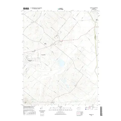
2016 Map of Waverly
USGS Topo · Published 2016About this map
The town of Waverly serves as a central hub on this 2016 survey, situated where agricultural fields meet the winding drainages of Highland Creek. The landscape reflects a well-established rural network, with numerous family-named roads like JW Berry Rd and Cambron Gipson Rd connecting smaller communities. This survey details the transition from the concentrated residential streets of Morganfield and Breckinridge Center to the rolling terrain of the Sulphur Spring Hills in the southwest. Local heritage is preserved through the mapping of small rural burial grounds, including Saint Peters Cem and McClure Cem. The drainage patterns of Casey Cr and Muddy Run illustrate the hydrology of Union County, while the northern border follows the historic line of Highland Cr at the boundary with Henderson County.
Find a feature on this map
64 named features on this map. Tap any name to fly to it.
Don’t see what you’re looking for? This feature index may not catch every label — zoom into the map to look around manually.
Map Details
Editions of this 2016 Waverly Map
This is the sole edition of this map. No revisions or reprints were ever made.
Other maps of this area

1906 · Sebree
USGS Topo · 1:62,500

1907 · Morganfield
USGS Topo · 1:62,500

1914 · Henderson
USGS Topo · 1:48,000

1916 · Henderson
USGS Topo · 1:62,500

1917 · Uniontown
USGS Topo · 1:62,500

1949 · Morganfield
USGS Topo · 1:24,000

1949 · Poole
USGS Topo · 1:24,000

1951 · Dixon
USGS Topo · 1:24,000

1951 · Poole
USGS Topo · 1:24,000

1951 · Waverly
USGS Topo · 1:24,000