
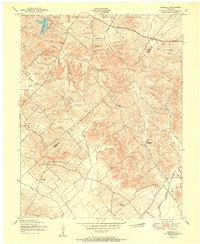
1951 Map of Waverly
USGS Topo · Published 1951About this map
The Camp Breckinridge Military Reservation dominates the southern half of this landscape, its sprawling installation and Landing Strip carved into the hills of Union County. Just north of the military boundary, the community of Waverly serves as a central hub, where the Illinois Central railroad crosses the terrain. The map records a rural economy in transition, where numerous Oil Field clusters are interspersed among traditional farmsteads and family cemeteries like Clements Cem and Highland Cem.
Find a feature on this map
33 named features on this map. Tap any name to fly to it.
Don’t see what you’re looking for? This feature index may not catch every label — zoom into the map to look around manually.
Map Details
Editions of this 1951 Waverly Map
This is the sole edition of this map. No revisions or reprints were ever made.
Other maps of this area

1906 · Sebree
USGS Topo · 1:62,500

1907 · Morganfield
USGS Topo · 1:62,500

1914 · Henderson
USGS Topo · 1:48,000

1916 · Henderson
USGS Topo · 1:62,500

1917 · Uniontown
USGS Topo · 1:62,500

1949 · Morganfield
USGS Topo · 1:24,000

1949 · Poole
USGS Topo · 1:24,000

1951 · Dixon
USGS Topo · 1:24,000

1951 · Poole
USGS Topo · 1:24,000
1951 · Bordley
USGS Topo · 1:24,000