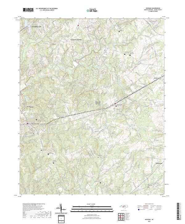
2022 Map of Waxhaw
USGS Topo · Published 2022About this map
Union County's southern landscape is defined by the headwaters of the Twelvemile Creek system, where Weddington, Wesley Chapel, and Mineral Springs mark the transition from rural crossroads to residential communities. The map is a critical resource for genealogists, as it documents an extensive network of family and congregational burial grounds including Bethlehem Church Cem, Piney Grove Church Cem, and the Waxhaw City Cem. These sites, often situated near historic road alignments like Old Waxhaw-Monroe Rd, trace the settlement patterns of early Waxhaw residents.
Find a feature on this map
46 named features on this map. Tap any name to fly to it.
Don’t see what you’re looking for? This feature index may not catch every label — zoom into the map to look around manually.
Map Details
Editions of this 2022 Waxhaw Map
This is the sole edition of this map. No revisions or reprints were ever made.
Other maps of this area

1905 · Charlotte
USGS Topo · 1:48,000

1907 · Charlotte
USGS Topo · 1:62,500

1941 · Charlotte
USGS Topo · 1:125,000

1941 · Spartanburg
USGS Topo · 1:250,000

1942 · Charlotte
USGS Topo · 1:125,000

1953 · Spartanburg
USGS Topo · 1:250,000

1953 · Charlotte
USGS Topo · 1:250,000

1954 · Charlotte
USGS Topo · 1:250,000

1960 · Charlotte
USGS Topo · 1:250,000

1960 · Spartanburg
USGS Topo · 1:250,000