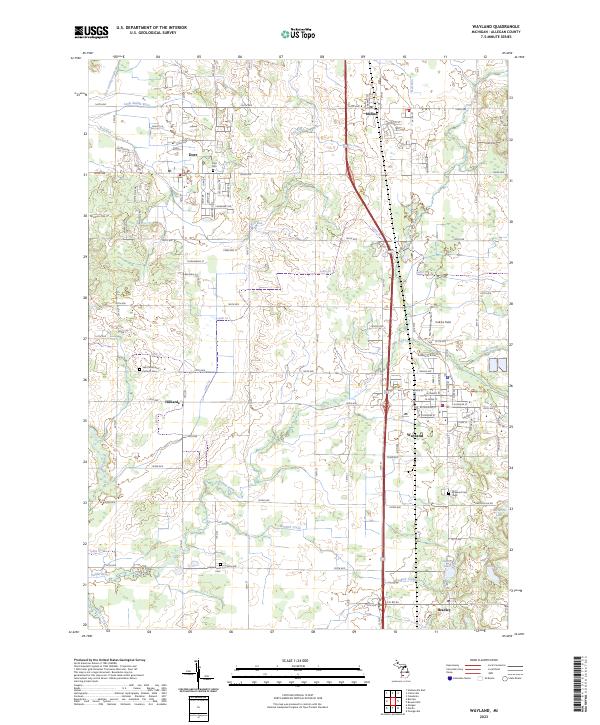
2023 Map of Wayland
USGS Topo · Published 2023About this map
Wayland serves as the central hub of this eastern Allegan County landscape, where the traditional grid of rural section lines meets modern transportation corridors. The map documents a corridor of settlements stretching from Dorr and Moline in the north down to Bradley in the south, following the historic path of transit through the region. This area is defined by the winding course of the Rabbit River and the Little Rabbit River, which meander through a patchwork of agricultural fields and woodlots. Genealogists will find significant value in the documentation of local burial sites, including the Dorr Cem, Saint Stanislaus Catholic Cem, and Maplewood Cem. The presence of small outlying communities like Hilliards illustrates the enduring settlement pattern of Western Michigan, where localized centers provided essential services to the surrounding farming community.
Find a feature on this map
50 named features on this map. Tap any name to fly to it.
Don’t see what you’re looking for? This feature index may not catch every label — zoom into the map to look around manually.
Map Details
Editions of this 2023 Wayland Map
This is the sole edition of this map. No revisions or reprints were ever made.
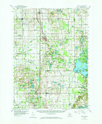
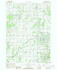
Historical Maps of Dorr Through Time
3 maps found